Geography
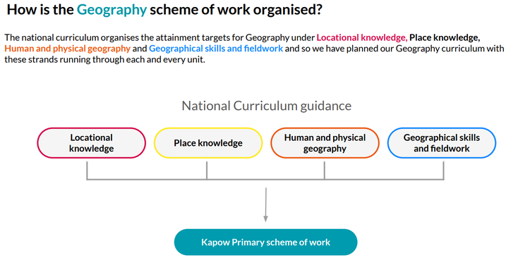
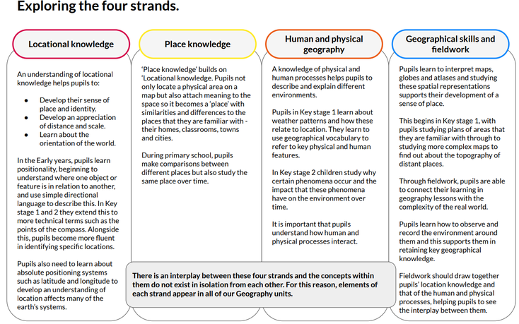
Kapow Primary’s Geography scheme of work aims to inspire pupils to become curious and explorative thinkers with a diverse knowledge of the world; in other words, to think like a geographer. We want pupils to develop the confidence to question and observe places, measure and record necessary data in various ways, and analyse and present their findings. Through our scheme of work, we aim to build an awareness of how Geography shapes our lives at multiple scales and over time. We hope to encourage pupils to become resourceful, active citizens who will have the skills to contribute to and improve the world around them. Our scheme encourages:
- A strong focus on developing both geographical skills and knowledge.
- Critical thinking, with the ability to ask perceptive questions and explain and analyse evidence.
- The development of fieldwork skills across each year group.
- A deep interest and knowledge of pupils’ locality and how it differs from other areas of the world.
- A growing understanding of geographical terms and vocabulary.
Kapow Primary’s Geography scheme of work enables pupils to meet the end of key stage attainment targets in the National curriculum. The aims also align with those in the National curriculum.
Winhills strive to share as much information about children's learning with family and friends. Each Year group sends home a Knowledge Organiser at the start of each topic for children to share with people at home. This encourages children to share their learning and enables adults to ask questions about the children's learning. It also contains links for children to further develop their learning at home. It is a visual summary of the learning the children will complete for that unit of work.
An example has been attached below. This knowledge organiser has been shared with all children and families in Year 4/5 to support learning with their topic 'Why do Oceans Matter?'
Year 4-5 Knowledge Organiser 'Why do Oceans Matter?'
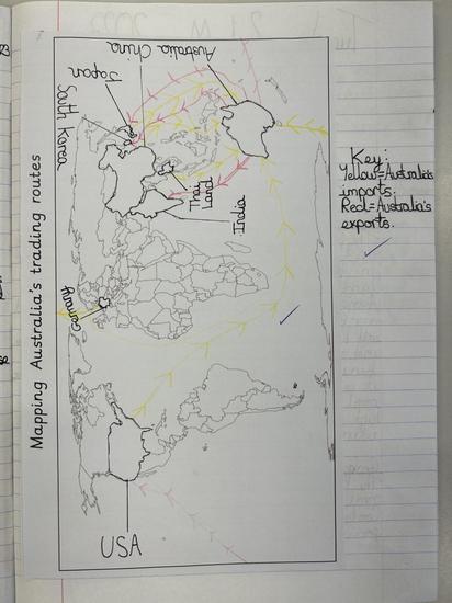
This is and example of a Year 5 child's work about the topic 'Why do Oceans Matter?'
During the first lesson, she wrote a paragraph about why oceans matter. She then extended her learning by mapping Australia's trading routes of imports and exports using the Oceans to trade. She had to use an atlas to find and label the countries and then had to colour code the routes to show which routes were importing goods and which were exporting goods.
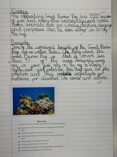
Another example of work is this non-chronological report about the Great Barrier Reef. The children had to use laptops to research the information and also use techniques they had learnt in English such as writing in cohesive paragraphs, using fronted adverbials and commas in a list.
